
Brampton’s new COVID-19 bike network interactive map shows loops for planning essential grocery, pharmacy and medical trips from the interim bike lanes along Vodden Street and Howden Boulevard.
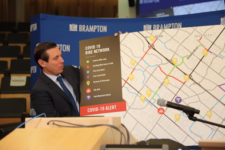
Mayor Patrick Brown unveiled the new map in City Hall on Apr 22nd. The press conference was covered by CP24 TV with this video link. Mayor Brown said in response to a question, “in this term of Council, you are going to see record investment in active transportation because we believe in it… cities are for people not cars”.

Look for Mayor Brown’ remarks starting at the 11:10 mark in the video link, where he unveils the map. Following that are remarks by the lead Councillor on the file, Rowena Santos. David Laing, Chair of BikeBrampton made his remarks (shown below) starting at the 14:53 mark. Subsequently, Mayor Brown took questions from the media.
Brampton Interim Bike Lanes – bicycle-friendly loops interactive map

The above Brampton bicycle-friendly loops map can be accessed online from City of Brampton’s website. It is an interactive GIS map that can be zoomed in for more detail. The tags on the right margin are map layers that can be clicked and unclicked to pinpoint the essential services that are located along the network loops from the interim bike lanes. You can use the interactive map for planning your essential trips.
David Laing’s remarks at Brampton City Hall press conference:
“My name is David Laing, chair of BikeBrampton, representing the cycling community. Today marks the 50th anniversary of first Earth Day celebration. It is therefore fitting that, while the COVID-19 pandemic continues to be a crisis felt around the world, it is also today providing a catalyst for what may be lasting and positive change that may well help us avert the worst effects of a climate catastrophe the likes of which would make COVID-19 pale by comparison.
The interim bike lanes provide a long-awaited and much needed safer cycling corridor for those needing to travel east – west through the City’s centre. The maps combine with this spine to create an active transportation network along less busy roads that will connect people to places where they work, buy groceries, buy medications, and avail themselves of other essential products and services.
This past Monday, I saw a cyclist in the bike lane riding on Vodden, west of Centre St. It was interesting that when he got to the end of the bike lane at Ken Whillans Drive, he immediately reverted to the sidewalk, which is both illegal and makes it impossible for him to practice safe social distancing with other cyclists and pedestrians.
I want to thank City staff, especially those in Transportation Planning and Traffic Services, for moving heaven and earth to get the lanes and the maps done quickly and efficiently. I’ve learned there is much more to this process than painting a few signs and dropping some construction barrels on a road!
In this time of hardship and social isolation, when we are frightened for our own health, and that of loved ones, and when so many are without a pay cheque, I want to thank Mayor Brown, Councillor Santos and the rest of Council for providing decisive leadership, for being empathetic to our situation, for recognizing how important it is for us to be able to be outside for exercise and recreation, for recognizing the need to provide more public space to allow for proper physical distancing for walkers and cyclists and for recognizing the need to provide us with transportation options that will both save us money and increase our chances of staying healthy.”

Mayor Patrick Brown said, “I’m glad Brampton is a leader in active transportation and I hope other cities will follow.”
You must be logged in to post a comment.