Brampton and Peel Public Health want your comments about a wayfinding Esker Lake Trail audit between Bovaird and Williams Parkway. Survey closes Nov 10, 5pm.
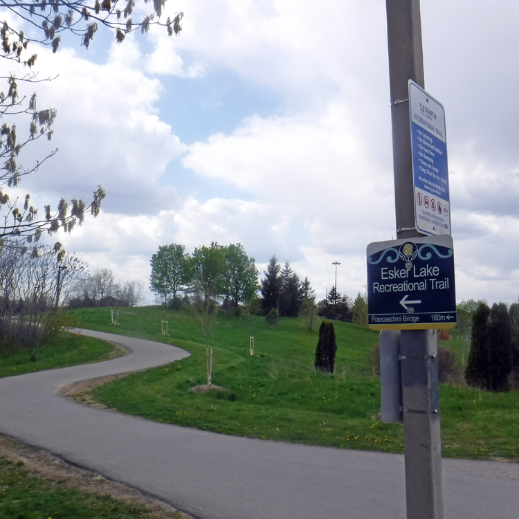
For many years, Active Transportation Advisory Committee and BikeBrampton advocates have requested better signage with wayfinding on our trails. Trails without signage can be confusing with multiple trail branches and intersections at unidentified roads. Most of us use trails & the streets to get to destinations.
Although this survey is targeted as a walking audit, you could ride this section of the trail. If you are familiar with the area, you can complete the survey at home using google maps.
Key Points to help you:
- Esker Lake Trail starts at Mayfield Road in the north, winds through Heart Lake Conservation Area, crosses #410 on the Franceschini bridge, Queen Street at West Drive and will ultimately end at Bramalea GO!
- The survey pilot is a 1km radius around Lakelands Village Park (at the Playground gazebo), corner of Southlake Blvd & Deep Sea Dr.
- Based on google maps walking routes here are the times:
- 24 minutes to nearest recreation centre: Century Gardens
- 22 minutes to Russell D. Barber Public School
- 28 minutes to North Park Secondary School
- 11 minutes to ZUM bus up on Bovaird Drive
- >30 minutes to Brampton transit on Williams Parkway
- >30 minutes to GO bus on Williams Parkway
- 42 minutes to shopping at Trinity Common Mall
- 1 hour (5km) to Chinguacousy library

